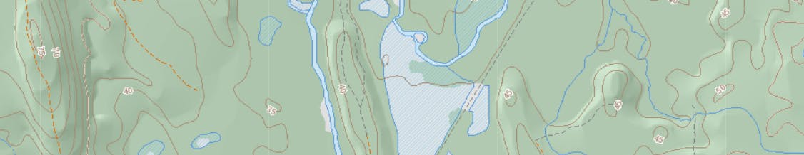
Water Features Setback: When discussing policy for setback distances between new development and wetlands, waterbodies and watercourses in the Municipal Planning Strategy and Land Use By-law, Council opted to refer to the Nova Scotia 1:10,000 topographic database to determine whether or not a water feature is present. Policy E-9 in the Municipal Planning Strategy states:
“Developments requiring a development permit shall set all buildings back from the edge of any watercourses, water bodies and wetlands as shown in the Provincial 1:10,000 topographic database.”
The regulations contained in the Land Use By-law under Section 3.5 expand slightly on this policy byContinue reading
Water Features Setback: When discussing policy for setback distances between new development and wetlands, waterbodies and watercourses in the Municipal Planning Strategy and Land Use By-law, Council opted to refer to the Nova Scotia 1:10,000 topographic database to determine whether or not a water feature is present. Policy E-9 in the Municipal Planning Strategy states:
“Developments requiring a development permit shall set all buildings back from the edge of any watercourses, water bodies and wetlands as shown in the Provincial 1:10,000 topographic database.”
The regulations contained in the Land Use By-law under Section 3.5 expand slightly on this policy by indicating that exceptions from the 1:10,000 topographic database may be made subject to the submission of a professional report which differs from what is shown on the 1:10,000 database.
Watercourses, water bodies or wetlands when referenced in this By-law, shall refer to those watercourses, water bodies, and wetlands identified in Nova Scotia Provincial Topographic Database mapping at a scale of 1:10,000, unless it can be proven otherwise through a professional assessment.
The ability to submit a professional assessment contrary to the 1:10,000 database was intended as an option to provide relief to property owners. It was envisioned that a property owner, if relatively certain that the data shown on the 1:10,000 database was inaccurate, could submit a professional assessment proving the water feature either does not exist on the property, or that its boundaries have shifted from what is shown. This mechanism was only intended to provide relief in certain situations and was not intended to be used to prove the existence of a previously unknown water feature. Staff have been advised that MPS policy E-9 and the corresponding LUB regulations are written in a manner which is open to an alternate interpretation, that would result in regulations contrary to Council’s intent of creating a mechanism to provide relief from setbacks.
This alternate interpretation allows the submission of a professional assessment proving that a previously unknown water feature which does not appear on the 1:10,000 database is present and requires setbacks outlined in the LUB. This could result in a situation where a neighbouring property owner submits a professional assessment showing the existence of a water feature to prevent or impede development. While unlikely to cause problems if submissions could only be made by the property owner, Policy E-9 and corresponding regulations do not make any distinction as to who may submit such evidence. Further, Policy E-9 does not clarify that the intent is to provide relief and is not looking to identify water features that do not appear on the 1:10,000 topographic database.
When deciding to use the NS 1:10,000 topographic database as the baseline to evaluate whether or not water features are present on a given property, Council made a conscious decision that features not appearing in the database, would not require setbacks or be provided the same protection as those features which do appear on the 1:10,000. If the existing language is left unchanged, the possibility exists that the policy and regulations could be used to block or prevent development that aligns with Council’s intention but is impacted by the wording in the LUB regulations.
Staff propose minor amendments to MPS Policy E-9 and LUB regulations to clarify the intent of Council and prevent misuse of this provision. The proposed amendments, attached as Appendix A, provide clarification that this option is available solely to the property owner (developer) to submit a professional assessment. The amendments further confirm that this provision is intended to provide relief in certain circumstances from what is shown on the 1:10,000 database and is not intended to provide or require a higher-level analysis or delineation for developments requiring a development permit.
LUB Zoning Map Amendment
In addition to the MPS and LUB amendments proposed above, staff also recommend a minor housekeeping amendment to improve Schedule “A”, the Zoning Map which forms part of the Land Use By-law as. The amendment involves changes to the data layers used in mapping software to create the Zoning Map. Changes to this data affect how zoning information is visually displayed at large scales only. It has been identified by staff that the “zoning layer” does not currently align with the “property boundaries layer”. This has resulted in some minor visual errors at large scales. Staff identified some areas near the coast where portions of lots appeared to have no zoning while shown at a large scale, when in fact all parts of the Municipality are zoned, with zoning extending to the ordinary high-water mark. This is due to updates to the provincial water and property mapping layers that have occurred since the creation of the municipal zoning layer. The proposed amendment will correct this error by aligning the zoning layer with the property layer. This change has no impact on the applicability of zoning in the Municipality and is simply a change to improve the quality and readability of the zoning mapping data at large scales. The change will not be visible to the naked eye on LUB schedule “A”.